Road management
Ensuring reliable and efficient movement of people and goods
Aim
Optimise real-time traffic management of the network, provide traveller information, improve asset management planning, and support service delivery.
About the program
This program of activities manages and operates the road network, the Road Network Operations Centre, road safety support, Heavy Vehicle Services, Network Operations and Planning and Technical Services.
* For more detailed information on our Key Performance Indicators and targets visit here.
Target 90%
Community satisfaction is within target with a slight increase from last year
Target 97%
Network available for use by B-Double - 27.5 metre met target and continues to show strong performance
Target 94%
Percentage of bridges reaching standard strength criteria met target
| Program expenditure $ million | 2022192 | 2023271 | 2024230 |

Looking ahead
Projects and activities planned for next financial year, include the following:
- Pinjarra Heavy Haulage Deviation - continue planning, and community consultation.
- Orrong Road planning and development study
- Nicholson Road, Garden Street and Yale Road grade separation move into delivery phase
- Tonkin Highway North Ellenbrook grade separation - entering delivery phase
- Smart Freeway on Mitchell Freeway southbound, between Hester Avenue and Vincent Street - operational
- Impacts from Armadale Train Line shutdown - continue support to minimise traffic impact
- Replacement of Fremantle Traffic Bridge - minimise traffic impact
- Implementation of our Roadmap for Cooperative ITS (C-ITS) to ensure a nationally harmonised approach
- Delivery of reduced speed limits at traffic warden controlled childrens crossings.
Some of these are already underway. Visit our website to find out more.
Smoothing the journey during
the Armadale Line shutdown

- 130 year old rail line is closed for 18 months as its transformed as part of METRONET
- New state of the art technology deployed to minimises impacts on commuters as rail replacement bus services ramped up
The 130-year-old Armadale train line is set to be transformed through three significant METRONET projects: Victoria Park-Canning Level Crossing Removal, the connection of the new Thornlie- Cockburn Link to the Mandurah and Thornlie lines, and Byford Rail Extension. Together these projects will deliver 5.5 kilometres of elevated rail lines, seven new stations and remove 13 level crossings.
To enable work on these major projects, the Armadale and Thornlie lines are currently shut until mid-2025.
Due to the busy nature of the routes involved, significant disruptions to the road network were expected. We worked alongside METRONET, Transperth, Public Transport Authority and Department of Transport teams, plus the Town of Victoria Park to develop a mitigation strategy for helping to manage traffic impacts and prioritising bus movements for the period of the shutdown that started in late 2023. The mitigation included delivering several Intelligent Transport Systems, operational measures and civil upgrades along key routes in the area.
We activated virtual receivers at 40 traffic signals to monitor bus movements on the network that had the ability to automatically keep traffic lights green for up to 30 additional seconds for late-running rail replacement buses.
Two fixed variable message signs and six portable signs were installed at key locations along the network providing drivers with real-time information and travel times for different routes. The aim was to enable drivers to make informed decisions about their journey on -route when unexpected disruptions occurred on the network arising from traffic or other incidents impacting journey times.
Additionally, nine new CCTV cameras were installed, and a dedicated Incident Response Service was created to monitor and support reliable journeys along Shepperton Road and Albany Highway. This new service provides our real-time operators with extensive coverage of key routes and enable us to rapidly respond to events and incidents.
Network operations
Cooperative Intelligent Transport Systems
Our Road Network Operations Centre (RNOC) is implementing Cooperative Intelligent Transport Systems (C-ITS) to benefit road users and transport operators in Western Australia. In May this year we released our Roadmap to Enabling C-ITS in Western Australia.
C-ITS refers to a group of technologies allowing effective data exchange and offering road users the right information at the right time, based on where they are and the situations they encounter on the road. It provides warnings and information to drivers as well as information to traffic operators for improving safety, movement and operational efficiency, environmental sustainability and customer experience.
C-ITS is advancing globally and, to realise benefits, there needs to be ongoing collaboration between government, industry, and road users. Our vision is supporting implementation of a nationally harmonised C-ITS ecosystem across the State's road network. By doing this we will enhance safety, movement, regional resilience and enable future vehicle technologies.
During the development of our Roadmap, we identified the following challenges to be addressed on our metropolitan, regional, and rural road networks:
- ensuring safety for all road users at signalised intersections
- keeping road users informed about changes to the road environment
- delivering real-time road network event alerts across metropolitan, regional and rural roads
- managing competing road-user priorities.
Our roadmap proposes potential C-ITS use-cases to help address key challenges and it plans the actions required over the next four years. Further information is available on our website.
ITS Awards
The ITS Australia Awards are the most prestigious, celebration of excellence in the Intelligent Transport Systems industry. In 2025 they will take place in Perth for the first time thanks to the efforts of our ITS Operations team and the connections they have built with ITS Australia and other industry partners.
Getting ready for Smart Freeway Mitchell Southbound
While already well-practised after starting the operation of Kwinana Freeway northbound in 2020, bringing the next smart freeway to Mitchell Freeway southbound, Hester Avenue to Vincent Street, is no small feat. The scale of Smart Mitchell Freeway Southbound and our continued commitment to provide world-class service, requires months of planning and preparation leading up to the deployment of the smart freeway's technologies and beyond. Work is well underway on operational readiness, including investigations into:
- network operations and performance strategy
- people readiness, including skills gap assessment and upskilling
- stakeholder management
- supplier procurement
- systems and processes required, including performance reporting to key stakeholders in the first days and weeks of operation.
Real-time operating platform
We are developing and embedding our intuitive interface for managing the road network that when complete all existing standalone ITS applications and systems will be integrated into a single platform that will:
- provide real-time visibility of traffic congestion across the metropolitan road network
- supply the analysis and reporting capability to assess effectiveness of actions taken
- provide visualisation, analysis and reporting capability
- deliver proactive network management, as well as support decision making
- unify and harmonise systems
- enable new capabilities to better collaborate and coordinate across the Transport Portfolio, minimising degradation to journey time reliability.
Heavy Vehicle Services
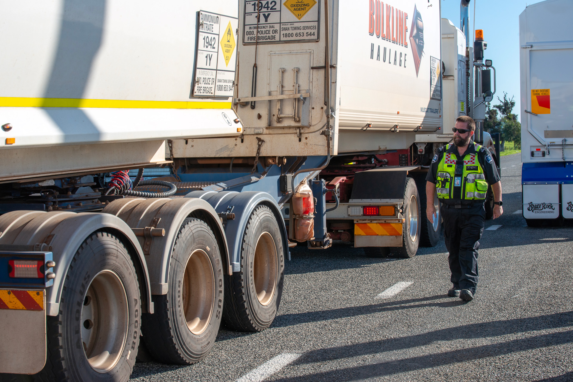
We are the Heavy Vehicle Regulator for Western Australia and are responsible for:
- facilitating and regulating the movement of restricted access vehicles across the state
- providing of a one-stop shop for permits and traffic escort services for over size, over mass movements
- administering the Heavy Vehicle Pilot Licencing Scheme, the WA Heavy Vehicle Accreditation (WAHVA) Scheme, and the training and certification of WAHVA Scheme auditors. Last year there were 5,096 transport operators enrolled in the WAHVA Scheme
- working with industry groups and other government agencies at a state and national level to improve heavy vehicle safety, productivity and equity of services across the freight transport industry.
By working with the National Heavy Vehicle Regulator, we enable the movement of restricted access vehicles between Western Australia and other states. We are continuing to see an increase in the number of permits issued, reaching a new high of 38,932 issued last year.
| Total Number of Permits Issued | 2022 | 2023 | 2024 |
|---|---|---|---|
| Single-trip permits | 11,852 | 9,252 | 11,847 |
| Traffic escort bookings* | 1,590 | 1,638 | 1,833 |
| Period permits | 21,822 | 22,731 | 22,780 |
| Special purpose vehicle permits | 2,445 | 2,247 | 2,472 |
| Total | 37,709 | 35,868 | 38,932 |
*Bookings can range from a half-day to up to seven days
Transition to new Telematics Monitoring Application
In May we announced that the Intelligent Access Program (IAP) is being replaced. Several other jurisdictions have already replaced IAP with alternatives for vehicle monitoring. We have been working to develop a new approach which was introduced midway through 2023 as a potential replacement for IAP in Western Australia. The new approach offers improved monitoring through enhanced functionality, adopts future proof technology, gives operator flexibility through a wider offering of applications and aligns with the national approach.
Planning and Technical Services
Network LiDAR project
LiDAR (light detection and ranging) is a system using lasers to make a digital 3D representation of areas of the Earth’s surface using point cloud data. Survey quality LiDAR and 360-degree imagery data for all main roads in the state network and the majority of on- and off-ramps, rotaries and principal shared paths have been captured. A helicopter-based system was used to capture unsealed roads to avoid running expensive vehicle-based systems on rough terrain. AI and machine learning has been used extensively to generate Australian Road Assessment Program (AusRAP) star rating data from the LiDAR and imagery data, securing our status as a pioneering organisation in this space. To date, no other agency in the world has undertaken this process at this scale. Approximately 70% of the network has been coded and extracted, and we will begin turning this data into AusRAP star ratings during the next 12 months.
Perth Transport Model
This project is an Australian-first initiative to integrate modelling for best practice activity-based person and tour based commercial vehicle travel demand across the metropolitan area. Over the past 12 months we have undertaken two key travel surveys: Perth Area Travel and Household Survey, and the Commercial Vehicle Survey. These offer a snapshot of personal travel behaviour and commercial vehicle activity. This data enables future modelling of distributional and social equity impacts of new transport infrastructure and travel-demand management initiatives. In addition, impacts from technologies and social changes, such as autonomous vehicles, ridesharing and working from home, can be modelled.
Sustainability planning ratings
We have been recognised by the Infrastructure Sustainability Council, a leading authority across Australia and New Zealand undertaking sustainability planning ratings for major infrastructure projects. The Infrastructure Sustainability Rating Scheme (IS) is Australia and New Zealand’s only comprehensive rating system for evaluating economic, social and environmental performance of infrastructure across the planning, design, construction and operational phases of infrastructure assets. Over the past 12 months we have completed five planning ratings – these included Manuwarra Red Dog Highway Stage 4, Mandurah Estuary Bridge widening and Eastlink Stages 1, 2 and 3 projects. We also completed the first ever program planning rating – achieving a silver rating. The learnings and processes developed are now being applied on other major state infrastructure projects such as the Westport project. Four other projects are currently in the process of preparing for a planning rating, including Orrong Road, Tonkin Highway North Ellenbrook grade separation, Pinjarra Heavy Haulage Deviation and Morrison Road railway level crossing removal.
Strategic research, innovation and collaboration
We develop and enhance our collective knowledge of economic, environmental and social topics through partnerships and research collaborations. We partner with industry and research institutions to undertake leading-edge road and transport research collaborating with:
- Austroads
- National Transport Research Organisation
- Western Australian Road Research and Innovation Program (WARRIP)
- Planning and Transport Research Centre
- Sustainable Built Environment National Research Centre
- iMove
- Western Australian Centre for Road Safety Research
- Australian Research Centre
Our internal Innovation and Research Program encourages our people to collaborate, learn, solve problems and explore new and innovative opportunities. This allows us to solve real business problems or explore new opportunities in conjunction with the organisations above as well as universities, Cooperative Research Centres and the private sector. During the year nine new projects were approved, and we have 17 active projects. Our new projects have a variety of topics and scope including investigating how concrete fills form, simulating potential new roundabout configurations and contributing to national work on Cooperative Intelligent Transport Systems.


