Road Mangement
Ensuring Reliable and Efficient Movement of People and Goods
Aim
Optimise real-time traffic management of the network, provide traveller information, improve asset management planning, and support service delivery.
About the Program
This program of activities manages and operates the road network, the Road Network Operations Centre, road safety support, Heavy Vehicle Services, Network Operations and Planning and Technical Services.

Target 90%
Community satisfaction with Main Roads slightly decreased from last year

Target 97%
Network available for use by B-Double - 27.5 metre met target and continues to show strong performance

Target 94%
Percentage of bridges reaching standard strength criteria met target
| Program expenditure $ million | 2021438 | 2022192 | 2023271 |
Looking Ahead
Projects and activities planned for next financial year, include the following:
- Develop planning for various projects including Orrong Road and Morrison Road Railway Level Crossing removal
- Expand the technology trials for selected vehicle priority at traffic signals
- Prepare to support Real Time Operations of Mitchell Freeway Southbound
- Implementation of a program to underground Western Power lines on key freight routes
- Trialling SMS notifications to the transport industry
Some of these are already underway. Visit our website to find out more.
Network Operations
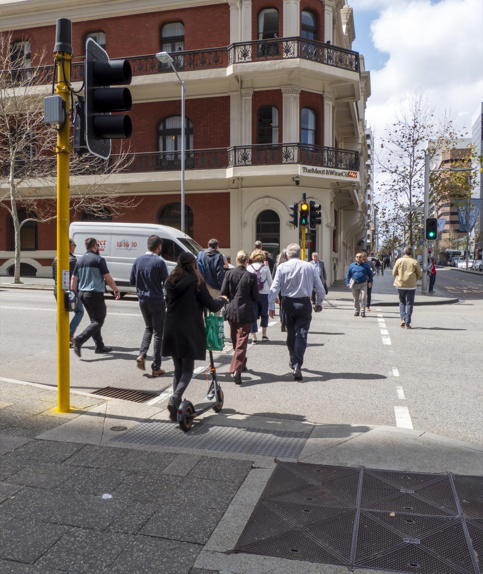
Innovations at Traffic Signals
This year the Performance-Led Innovations at Traffic Signals (PLlaTS) program trialled two pedestrian crossing innovations. Upon completion of the trial period, a report will be prepared for further consideration and to inform decision making around further rollout of these innovations.
- Kerbside Detection will address the issue of pedestrians pressing the button at traffic signals, and then walking away. By using sensors to create a detection zone, the technology continuously scans the area for pedestrian presence, if a pedestrian is not detected the phase call is cancelled. The Kerbside Detection trial is expected to provide efficiency benefits to traffic by not stopping the traffic phase when a pedestrian has already moved on.
- On-Crossing Detection senses the amount of time a pedestrian requires if this varies from the given clearance time to complete the crossing. Sensors continuously identify the presence of pedestrians on the crossing and walk-time is extended if pedestrians are detected. This is expected to provide safety benefits for vulnerable or slow-moving pedestrians as well as efficiency benefits by reducing the clearance time when faster moving pedestrians are crossing.
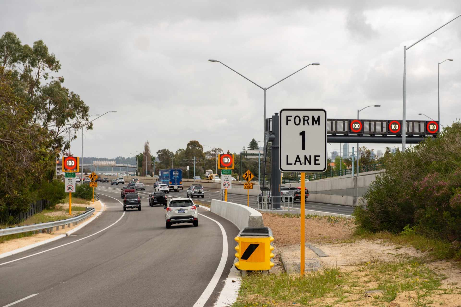
Reduced maximum speed at traffic signals
Research has shown that reducing the speed limit on the approaches to intersections reduces both crash probability and severity. The reduction of the maximum speed limit at traffic signals is anticipated to provide a 15 per cent reduction in killed or seriously injured (KSI) crashes, making roads safer and saving lives. This year 33 intersections were treated and parallel speed zoning assessments were undertaken to assess the speed against the road environment, whilst aiming to reduce the number of speed limit changes for road users. The program to adjust maximum speed limits at signalised intersections with a limit greater than 70 kilometres per hour is two-thirds complete and will be concluded in the coming year.
Getting Ready for Smart Freeway Mitchell Southbound
While already well-practiced after starting the operation of Kwinana Freeway northbound in 2020, bringing the next Smart Freeway to Mitchell Freeway Southbound (Hester Avenue to Vincent Street) is no small feat. The scale of the Smart Freeways Mitchell Southbound and our continued commitment to provide world class service, requires months of planning and preparation leading up to the inaugural day of the Smart Freeway’s operation and beyond. Work is well underway on operational readiness project including investigations into:
- Network operations and performance strategy
- People readiness including skills gap assessment and upskilling
- Stakeholder management
- Supplier procurement
- Systems and processes required including performance reporting to key stakeholders in the first days and weeks of operation.
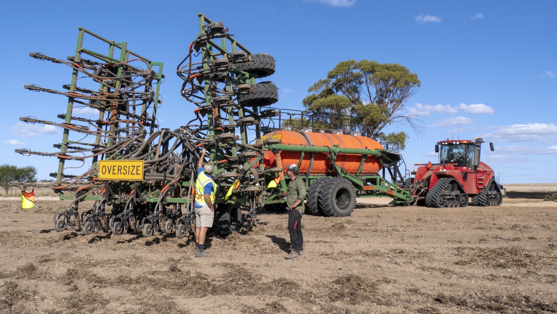
Heavy Vehicle Services
We are the heavy vehicle regulator for Western Australia and are responsible for:
- Facilitating and regulating the movement of Restricted Access Vehicles across the state
- Providing a one-stop shop for permits and traffic escort services for oversize, over mass movements
- Administering the Heavy Vehicle Pilot licencing scheme, the WA Heavy Vehicle Accreditation Scheme and the training and certification of WA Heavy Vehicle Accreditation scheme auditors
- Working with industry groups and other government agencies at a state and national level to improve heavy vehicle safety, productivity, and the equity of services across the freight transport industry
By working with the National Heavy Vehicle Regulator, we enable the seamless movement of Restricted Access Vehicles between Western Australia and other states. As shown below we are continuing to see an increase in the number of permits issued reaching a new high of 37,480.

| Total Number of Permits Issued | |||
|---|---|---|---|
| 2021 | 2022 | 2023 | |
| Single Trip Permits | 13,706 | 12,795 | 10,936 |
| Period Permits | 18,951 | 21,023 | 23,828 |
| Special Purpose Vehicle Permits | 2,559 | 2,953 | 2,716 |
| Total | 35,216 | 36,771 | 37,480 |
The Road Train Domain Campaign
During the year we worked on the delivery of new creative material to complement the heavy vehicle awareness campaign #biggerthanyou which has been running since 2021. The oversize over mass and agricultural implements campaign continued to run coinciding with peak holiday and harvest periods and acted as a timely reminder for people travelling. Our 2023 community awareness campaign focussed on interacting with road trains and was launched to coincide with the April 2023 school holiday period. In line with #biggerthanyou, #roadtraindomain has a dedicated page on our website.
A road train warning sign trial ran in parallel with the trial signage aimed to provide motorists with a visual clue that indicated how long and what type of road train is in front of them. The safety initiative was designed to assist road users to make informed decisions about how they share the road with and overtake road trains. As part of the trial motorists had the opportunity to provide feedback on My Say Transport. The feedback indicated the need for more education around road trains and awareness with 70 per cent of survey respondents saying that the new signage enabled road users to make more informed decisions when overtaking road trains. Road trains are the most common type of Restricted Access Vehicle (RAV) operating on our road network. With ongoing promotion, we will continue to educate and inform road users of the risks to change perception and ultimately change behaviour leading to improved safety for everyone.

Heavy Vehicle Travel Impacts
At the beginning of the year, we introduced Heavy Vehicle Travel Impact Notifications to permit operating conditions, when relevant to a transport operators’ journey. We also made some changes to the Travel Impacts webpage making the information easier to search and filter improving the ability of operators to plan their journey. As a result of feedback received at our most recent Industry Workshop and Information Sessions, we have now incorporated the impact notices into the RAV Mapping Tool. The introduction of the Travel Impact Notifications mapping layer allows users to “spatially” view planned road closures and restrictions on the road network that may impede the movement of RAV’s. In addition to the mapped travel impact information operators can search, print and filter notifications relevant to their journey.
Planning and Technical Services
EastLink WA
This project is a culmination of more than 40 years of road planning activities for the north-eastern corridor of the Perth Metropolitan area and Wheatbelt region, comprising several separate projects that have undergone different levels of planning and development. Together, these projects make up a proposed 80 plus kilometre stretch of road between Reid Highway and Northam. Due to the potential scale and significance of project impacts, the Integrated Project Team have utilised local knowledge and data from planning studies and engagement to identify improved options and proactively mitigate, where possible, adverse impacts.
EastLink WA proudly became the first ever project in Australia to develop and adopt a Program Planning rating. The Infrastructure Sustainability Council rating scheme served as our guiding framework, covering material usage, energy efficiency, water conservation, climate resilience, stakeholder engagement, and environmental impact reduction. In addition, the project earned a Silver Planning Rating for the Reid Highway grade separations project. These significant achievements have led to EastLink WA being shortlisted for an ‘Outstanding Achievement’ award at the Infrastructure Sustainability Council Connect industry event later this year.

Remotely Piloted Aircraft Systems
Use of Remotely Piloted Aircraft Systems (RPAS) on our projects continues to grow both for us and our contractors. Data captured by these systems assist in informing decisions, providing project updates, and delivering innovative solutions for staff. Remote technology solutions such as RPAS allow regional and Metropolitan remote pilots to capture and process data for high quality imagery and volumetric reports for materials pits. All regions are taking advantage of this solution for accurate and timely information to support construction activities. For our RPAS operation we utilise an online system to manage all flights and collect records in compliance with Civil Aviation Safety Authority requirements. This data provides insights into the use and performance of our pilots and aircraft.
Perth Transport Model
This project is an Australian-first initiative that will enable an integrated approach to modelling person-based travel demand and commercial vehicle travel demand across the Perth Metropolitan area. The project will integrate modelling for best practice activity-based person travel demand as well as a tour-based, commercial vehicle model. Over the last 12 months the initial prototype was developed in collaboration with international experts and there has been extensive collaboration with our Portfolio partners to ensure that the project leads to a consistent approach in transport planning and infrastructure project decision-making.
In the year ahead, the model will be calibrated to Perth Metropolitan area conditions. This will enable future ability to model the distributional impacts and social equity impacts of new transport infrastructure and travel demand management initiatives. In addition, the impact of future technologies and social changes can be modelled, such as the impact of autonomous vehicles, ridesharing, and the impacts of working from home.

Strategic Research and Innovation
We undertake significant activity to enhance our knowledge of economic, environmental, and social topics through a range of partnerships and research collaborations. By closely collaborating and partnering with industry and research institutions we undertake leading-edge road and transport research. These collaborations and partnerships include:
- Austroads
- National Transport Research Organisation (formerly ARRB)
- Western Australian Road Research and Innovation Program (WARRIP)
- Planning and Transport Research Centre (PATREC)
- Sustainable Built Environment National Research Centre (SBENRC)
- Western Australian Centre for Road Safety Research
- Universities, Cooperative Research Centres, and the private sector
Our internal Innovation and Research Program encourages collaborating to learn and solve problems while exploring new and innovative opportunities allowing us to solve real business problems. During the year, 12 new projects were approved, and 18 projects are currently active. The new projects include trialling use of connected vehicle data and evaluating improvements in line marking for improved safety and maintenance.