Results based service delivery.
Reduce the State’s road fatalities to the lowest in Australia by minimising the road factors contributing to road trauma and reducing the serious crash injury rate.
The program includes:


|
Project |
Total Project Cost ($ million) |
2014-15 Cost ($ million) |
Completion Date |
Description |
|---|---|---|---|---|
|
Goldfields – Esperance Region |
||||
|
Coolgardie Esperance Highway |
0.7 |
0.7 |
February 2015 |
Widen formation to 11 m and seal 9 m. |
|
Great Eastern Highway and Carins Road intersection upgrade |
1.2 |
1.2 |
December 2014 |
Upgrade to accommodate 53.5 m road trains. |
|
Great Eastern Highway and Focus Minerals / FMR Access Road intersection upgrade |
1.6 |
1.6 |
February 2015 |
Upgrade to accommodate 53.5 m road trains. |
|
Great Southern Region |
||||
|
Albany Highway near Narrikup |
1.2 |
1.2 |
March 2015 |
Construct south bound passing lane. |
|
Albany Highway |
1.5 |
1.5 |
March 2015 |
Construct north bound passing lane. |
|
Albany Lake Grace Road |
2.5 |
1.1 |
October 2014 |
Extend culverts and widen seal to allow for two 3.5 m wide traffic lanes. |
|
Metropolitan Region |
||||
|
Electronic School Zones Signs |
36.0 |
3.9 |
June 2017 |
Install 3,700 Electronic Speed Limit Signs at every school in Western Australia. |
|
Mid West - Gascoyne Region |
||||
|
North West Coastal Highway Widening – Northampton to Binnu |
1.7 |
1.7 |
May 2015 |
Widen seal to 9 m and install audible edge lines. |
|
Wubin Mullewa Road upgrade |
21.6 |
7.4 |
October 2014 |
Widen road between Perenjori and Morawa to two lane seal. |
|
Pilbara Region |
||||
|
Great Northern Highway – North of Newman |
2.0 |
2.0 |
March 2015 |
Widen and seal shoulders to 1 m and install audible edgelines. |
|
North West Coastal Highway – Why Why Creek and George River |
1.0 |
1.0 |
June 2015 |
Widen shoulders and seal to 11 m formation and install audible edgelines. |
|
South West Region |
||||
|
Brockman Highway |
3.6 |
3.6 |
May 2015 |
Realign to improve geometry and widen to a 9 m seal including 1 m sealed shoulders. |
|
Bussell Highway – Carbunup to North Jindong |
1.6 |
1.6 |
December 2014 |
Reconstruct and widen to a 10 m seal including 1.5 m sealed shoulders and construct a northbound passing lane. |
|
Coalfields highway |
27.5 |
12.7 |
June 2015 |
Realign over Wellington Dam at Hamilton River to provide 11 m seal including 1.5 m sealed shoulders and a 1 m painted centre median. |
|
Collie – Lake King Road |
3.0 |
3.0 |
November 2014 |
Seal shoulders 1 m wide and provide edge lines. |
|
Wheatbelt Region |
||||
|
Brookton Highway / McPherson Street, Hyden |
0.8 |
0.4 |
April 2015 |
Upgrade intersection to improve turning movement of 36.5 m road trains. |
|
Collie – Lake King Road |
2.3 |
2.3 |
April 2015 |
Widen and seal shoulders west of Darkan. |
|
Goomalling – Toodyay Road / Bejoording Road |
1.6 |
1.3 |
June 2015 |
Provide right and left turning pockets and relocate intersection to create staggered T-intersections. |
The State has invested more than $7 million to improve the safety of railway level crossings, on works such as:
We ran a series of risk workshops with Public Transport Authority focusing on the risk exposure at electrified rail network level crossings. These workshops resulted in short-term projects to reduce level crossing risks.

The Safe System approach recognises that road users are not infallible; they make mistakes and errors of judgement. They also have a limited tolerance to physical impact forces.
The new approach directs us to provide a road network where mistakes do not lead to severe consequences. We can only achieve this by working to reduce the number of mistakes road users make and reduce the consequences of those mistakes. Actions to achieve this include:
Our ROSMA framework consists of policies, procedures and tools to integrate the Safe System approach as part of our everyday business. We have already:
We must provide a road network where mistakes by road users do not lead to severe consequences

Our South West Region team completed the project a year ahead of schedule. Works included:
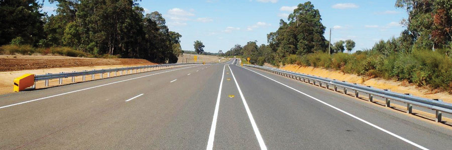
The highway is now safer for road users and provides more opportunities to easily overtake slow vehicles. The new safety barriers protect roads users from vegetation close to the edge of the road and protect vehicles at steep embankments. The highway also now caters for increased traffic volumes, including heavy vehicles and oversized loads servicing the mining, industrial and agricultural sectors.
The project presented a number of challenges such as extensive earthworks in difficult terrain, an upgrade of road drainage and road gradient improvements. Addressing these challenges resulted in enhanced safety for all road users including commuter cyclists.
The project formed part of the Government’s commitment to improve the safety of Coalfields Highway and strengthen the connectivity between Wheatbelt Region and Bunbury Port Facility.
Works to realign and reconstruct the 2.6 kilometre Hamilton River section of Coalfields Highway between July 2014 and May 2015 improved the overall safety and freight efficiency of the highway.
CONNECT WITH US